Showing posts with label trekking. Show all posts

Saturday, August 17, 2013

PAKSHIPATHALAM


Situated at an altitude of 1740m and accessible only by trekking, Pakshipathalam is home to several species of birds and is an ornithologist's paradise. It is located in the Brahmagiri Hills near Thirunelly. There is a cave here, which according to legend, was used by rishis (saints) for meditation in ancient times, has become a major attraction for tourists.

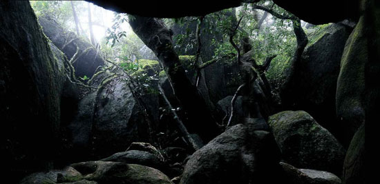
It is a challenging tourist spot for any adventure-seeking tourist. The deep rock caves; formed among the thick blocks of rocks at the northern top end of the Brahmagiri are the abode of various birds and wild beasts. The place is bet knows for the presence of `Edible Nest Swift light' as its nest is made of solidified saliva and is used to make bird's nest soup.

Here virgin forests, streams and steep hills together offer challenging avenues for trekking.

Location
North Wayanad, near Tirunelli temple.
Distance Chart: Mananthavady: 36km/ Kalpetta: 71km/ Sulthan Bathery: 78km

How to reach
Pakshipathalam is about 7 km away from Thirunelli and trekking is the only mode of reaching this place. Thirunelli is about 32 km from Mananthavady. Buses are available upto Thirunelli Temple.

The trekking starts from North Wayanad Forest Division. From there one would reach the first point, which is the Watch Tower in one and half hours. The Kerala Karnataka border is in 2 km distance from the watchtower. Though Pakshipathalam situated in Kerala, we can reach there only through Karnataka. The landmark after the watchtower is Pancharathodu, which is 2 km away from Kerala Karnataka border.

Then Pakshipathalam is just 500 m away for Pancharathodu. The trekking is for total 7.5 km, which can be completed with approximately three and half hours.

Bus timings: to Tirunelli from Mananthavady bus stand: 5.50am, 7am, 8.15am, 8.40am, 8.55am, 9.15am, 10am, 11am, 12.10pm, 1pm, 2pm, 2.45pm, 3.35pm, 4.10pm, 5pm, 5.45pm, 6.30pm, 8.30pm

To Mananthavady from Tirunelli: 7am, 7.40am, 8am, 8.40am, 9am, 9.30am, 9.45am, 10.25am, 10.35am, 11.20am, 11.40am, 1.10pm, 1.45pm, 2.45pm, 3.45pm, 5.10pm, 5.45pm, 6.30pm

Things to be noted
Trekking must be started at 7.30 itself, as total 7 hours would be needed for the total journey
Keep 
silence during trekking
Obey the instructions of the guide
Carry a first aid kit with needed medicines
Don't use plastic bottles and kits
Never disturb the birds and animals
Use jungle boots for trekking
Carry a battery torch with enough batteries
To save from leaches, rub a mixture of tobacco and mustard oil in legs. Carry tobacco and salt.
If leach bites you, don't try to pull them off. Just pour salt or tobacco over them.
Don't use liquor and cigarettes.
If there are mists covering your view, continue the trekking only after it depletes.

Contact
STD CODE: 04935
Trekking permitting authority, DFO, North Wayanad: Ph: 04935- 240233
Tirunelli forest station: Ph: 04935- 210377
Begur range officer: Mobile: 09447449119
Useful Info
Trekking Fees: Rs.8.00 for a group of 5 persons, Rs 100 for extra person, For foreigners, Rs 1000 for 5 member group.
Tips
Trekking starts from North Wayanad Forest Division 18. First point: Watch tower (3km away), Then Kerala-Karnataka border (2km from watch tower). Cross Pancharathodu in Karnataka (2 kms from Kerala-Karnataka border). Pakshipathalam is just 500m away from Pancharathodu. Total 7.5 km trekking, almost three and half hour journey.


COURTESY-http://www.mathrubhumi.com/travel


Saturday, April 28, 2012

NEELIMALA


Closer to Vaduvanchal, Neelimala is an excellent venue fro trekking with lots of stimulating trails. The summit of this hill affords a great view of the cascading Meenmutty fallsand the beautiful valley in its foreground.
Distances from: KPA-27 Km, SBY-26 Km, MDY-62 Km.....
How to Reach  District:WayanadNearest Bus Station:KalpettaNearest Railway Station:Kozhikode railway stationNearest Airport:Karipur International Airport at a distance of 95 kms

RANIPURAM

Ranipuram (ooty of kerala Malayalam: റാണിപുരം) is a hill station located withinKasargod district of Kerala state[Panathady Panchayat, Hosdurg Taluk], south India. It is located about 48 kilometres (30 mi) east of Kanhangad on the Panathoor road branching off at Panathady and lies 750 m (2,460 ft) above sea level adjacent to Bhagamandala forest range. Panathady-Ranipuram 10KM.
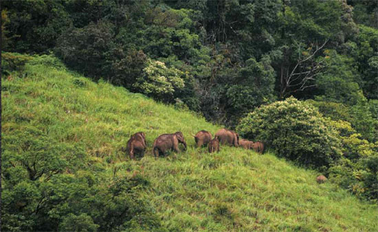
There are two trekking routes available through the South Western Ghats moist deciduous forests. Part of the way the climb is assisted by cut steps. The ambiance of the forest trail is remarkable and once you reach the "Mani" (grass covered hilltop) the view is superb. The undulating cloud-topped hills stretch up to the plains and ocean on the horizon. This is unexplored territory for the nature enthusiast and birdwatcher. Butterflies are in abundance and birds of the evergreen biotope like the blackeagle,crested serpent eagle and little spider hunter common. Elephants pay visits in the summer months and leopards have been sighted in the not-too-distant past. The Ranipuram forest should be declared as a wild life sanctuary by Kerala Forest Department to merge with borders of Thalakavery wild life sanctuary in Karnataka. The proposed Ranipuram Wildlife Sanctuary may protect and maintain overall biodiversity of the area in a better way. The place holds immense potential for ecotourism and may develop into a premier hill station in Kerala with the judicious development of amenities. Tourist cottages are available here provided by the KTDC and some private players have entered the scene. The proposed Ranipuram Wildlife sanctuary will be a boon to tourism development in Kasaragod district.

Tuesday, September 6, 2011

AGASTHYAKOODAM

 
 Elevation :1868 METERS
LOCATION  Thiruvananthapuram,


Agasthya Mountain is also referred as Agasthyakoodam and is located about 70 kilometers from  Thiruvanathapuram, capital city of Kerala State in India. It is located at a height of 1,868 meters (6129 feet) above mean sea level. The peak is the second highest peak in Kerala, South India. Agasthyakoodam peak is in the form of a sharp cone and is considered a heaven of rare herbs and Medicinal plants. A valuable and rare herb by name ‘Arogyapacha’ (Plant of eternal health) is attracting the attention of modern researchers to this hill. Agastyakoodam is the source of the Perennial River Thamiarabarni. The river flows in Tirunelveli District of Tamilnadu. Peppara wild life Sanctuary, a part of Agastyakoodam Forests is in Thiruvananthapuram district.
The Peppara Dam was constructed across the river Karamana in 1984. The main purpose of the Dam is to effect water supply to the Thiruvananthapuram city and suburban areas. Agastyakoodam is highly respected by both the Hindus as well as the Buddhists. This is because the Hindus believe that this mountain is the home of Sage ‘Agastya’; transitelerated as Agathiar or Agastyar. He is in some ways regarded as the patron saint of much of the south India. Some say that it was the Sage ‘Agastya’ who first brought and popularized the Vedic religion to South India. Agastya is considered to be one of the seven ‘Rishis’ (Saptarshi) of Hindu ‘Puranas’. Buddhists think that Agastya Mountain is the abode of Bodhisatva Avalokiteswara.

Friday, July 24, 2009

Chethalayam Waterfalls


Located 12 kms from Sulthan Bathery on the Pulpalli Main Road, are the breathtakingly beautiful Chethalayam Waterfalls.

For a glimpse of this lovely waterfall, one has to trek a distance of around 4 kms from Chethalayam. Wayanad Wildlife Sanctuary, also known as Muthanga Wildlife Sanctuary is another tourist spot. Here you can see elephants, spotted deer, guar, sambhar and sloth bear.

About 15 km from Sultan's Bathery, the Wildlife Sanctuary covers over 344-sq. km. and forms part of the area of Mudumalai Sanctuary in Tamil Nadu and Bandipur Sanctuary in Karnataka.

General Information

Location
12 Kms From Sulthan Bathery, Kerala

Tuesday, June 10, 2008

Munnar - Idukki

Munnar in Idukki district is situated at the confluence of three mountain streams - Mudrapuzha, Nallathanni and Kundala. 1600 m above sea level, this hill station was once the summer resort of the erstwhile British Government in South India. Sprawling tea plantations, picture-book towns, winding lanes and holiday facilities make this a popular resort town. Among the exotic flora found in the forests and grasslands here is the Neelakurinji. This flower which bathes the hills in blue every twelve years, will bloom next in 2018 AD. Munnar also has the highest peak in South India, Anamudi, which towers over 2695 m. Anamudi is an ideal spot for trekking.

Wednesday, April 23, 2008

NELLIYAMPATHY

Nelliyampathy

Nelliyampathy is an amazing hill station on the western ghats mountain ranges in Palakkad district of Kerala, 60km from Palakkad town, is one of the best places for ecotourism in Kerala. The green lush forests covering the whole hill area, coffee, tea, cardamom, vegetable and orange plantations, water falls and the misty and cool climate of Nelliyampathi offering a delightful vacation for the tourists.

Nelliyampathy is situated at a height of 467 m to 1572 m above sea level. Journey to Nelliyampathy itself thrilling. There are about ten hairpin curves on the way. The road is narrow and it is recommended that one who drives the vehicle should be experienced to drive in such roads.

Pothundi Dam is one important picnic spot near, in a distance of 21 km away from Nelliyampathy. Pothundi Dam is an irrigation Dam. The speciality of this Dam is that, it is built without cement or concrete. A mixture of jaggery and quick lime is used in place of cement to construct this dam. This Dam, built in late 1800 AD is a real wonder for the new technology. Boat services are there in the reservoir of Pothundy Dam. The sight of Nelliyampathi mountains from here is quite spectacular.

Seetharkundu is one important spot of attraction in Nelliyampathy. There is a waterfall about 100m in height. It offers a fantastic sight of the valley below. We can see one-third of the entire Palakkad area from here.

Nelliyampathy is the paradise for nature lovers and trekkers. Several species of birds and animals including some rare species are found here. The tea plantation and coffee plantations of Nelliyampathy are famous.

Nearest town Nenmara is about 30km away from here. Thrissur town is 48 km away from Nenmara.


Online Marketing
Praca poznań w Zarabiaj.pl