Showing posts with label KERALA PICNIC SPOT. Show all posts

Saturday, August 17, 2013

PAKSHIPATHALAM


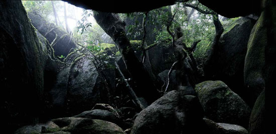
Situated at an altitude of 1740m and accessible only by trekking, Pakshipathalam is home to several species of birds and is an ornithologist's paradise. It is located in the Brahmagiri Hills near Thirunelly. There is a cave here, which according to legend, was used by rishis (saints) for meditation in ancient times, has become a major attraction for tourists.

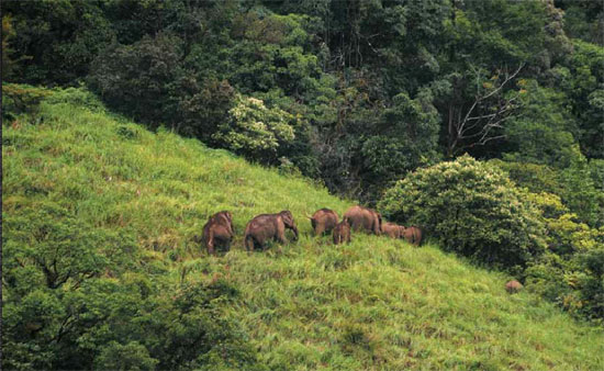
It is a challenging tourist spot for any adventure-seeking tourist. The deep rock caves; formed among the thick blocks of rocks at the northern top end of the Brahmagiri are the abode of various birds and wild beasts. The place is bet knows for the presence of `Edible Nest Swift light' as its nest is made of solidified saliva and is used to make bird's nest soup.

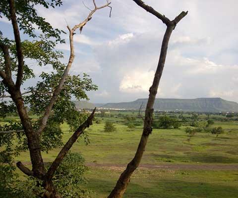
Here virgin forests, streams and steep hills together offer challenging avenues for trekking.

Location
North Wayanad, near Tirunelli temple.
Distance Chart: Mananthavady: 36km/ Kalpetta: 71km/ Sulthan Bathery: 78km

How to reach
Pakshipathalam is about 7 km away from Thirunelli and trekking is the only mode of reaching this place. Thirunelli is about 32 km from Mananthavady. Buses are available upto Thirunelli Temple.

The trekking starts from North Wayanad Forest Division. From there one would reach the first point, which is the Watch Tower in one and half hours. The Kerala Karnataka border is in 2 km distance from the watchtower. Though Pakshipathalam situated in Kerala, we can reach there only through Karnataka. The landmark after the watchtower is Pancharathodu, which is 2 km away from Kerala Karnataka border.

Then Pakshipathalam is just 500 m away for Pancharathodu. The trekking is for total 7.5 km, which can be completed with approximately three and half hours.

Bus timings: to Tirunelli from Mananthavady bus stand: 5.50am, 7am, 8.15am, 8.40am, 8.55am, 9.15am, 10am, 11am, 12.10pm, 1pm, 2pm, 2.45pm, 3.35pm, 4.10pm, 5pm, 5.45pm, 6.30pm, 8.30pm

To Mananthavady from Tirunelli: 7am, 7.40am, 8am, 8.40am, 9am, 9.30am, 9.45am, 10.25am, 10.35am, 11.20am, 11.40am, 1.10pm, 1.45pm, 2.45pm, 3.45pm, 5.10pm, 5.45pm, 6.30pm


Things to be noted
Trekking must be started at 7.30 itself, as total 7 hours would be needed for the total journey
Keep 
silence during trekking
Obey the instructions of the guide
Carry a first aid kit with needed medicines
Don't use plastic bottles and kits
Never disturb the birds and animals
Use jungle boots for trekking
Carry a battery torch with enough batteries
To save from leaches, rub a mixture of tobacco and mustard oil in legs. Carry tobacco and salt.
If leach bites you, don't try to pull them off. Just pour salt or tobacco over them.
Don't use liquor and cigarettes.
If there are mists covering your view, continue the trekking only after it depletes.

Contact
STD CODE: 04935
Trekking permitting authority, DFO, North Wayanad: Ph: 04935- 240233
Tirunelli forest station: Ph: 04935- 210377
Begur range officer: Mobile: 09447449119
Useful Info
Trekking Fees: Rs.8.00 for a group of 5 persons, Rs 100 for extra person, For foreigners, Rs 1000 for 5 member group.
Tips
Trekking starts from North Wayanad Forest Division 18. First point: Watch tower (3km away), Then Kerala-Karnataka border (2km from watch tower). Cross Pancharathodu in Karnataka (2 kms from Kerala-Karnataka border). Pakshipathalam is just 500m away from Pancharathodu. Total 7.5 km trekking, almost three and half hour journey.


COURTESY-http://www.mathrubhumi.com/travel


KULIRMALA

Kulirmala is a spectacular hill situated near Perinthalmanna. Kulir means cold or  chillness; not a simple chillness but a happy mood creating chillness. Mala is hill or mountain. This is the highest point in Perinthalmanna and from here we can view the complete area! The place is rich with verdant landscapes and water springs. Local people believe that the mythological character of Hanuman had been here once upon a time and they still believe the huge mark on the hill as the foot-mark of Hanuman. Distance from Perinthalmanna 1.5 km. 

Saturday, April 28, 2012

JAIN TEMPLE


Jain Temple Wayanad…Serenity’s Example

Jain temple Wayanad is an important tourist spot for Jains and multi cultural guests. This is an excellent piece of Jain architecture. It is a must see not only for Jains but also for other tourists and multi cultural guest who are on visit to the heavenly Wayanad.

Jain temple Wayanad is located near Sulthan Bathery. Jain temple Wayanad is also known by the name Ananthanatha swami temple. Ananthanatha swami temple is an excellent spiritual spot. This Jain temple Wayanad is dedicated to the great Jain saint by name Ananthanatha swami.

Ananthanatha swami temple is located near Kalpetta at a distance of six Km from Kalpetta. This Jain temple Wayanad is generally referred to as Tippu’s fort. There is an interesting reason behind this name being given to Ananthanatha swami temple. King Tippusultan stored his ammunition in this fort during his reign. That is why this place is called Tippu’s fort. Another name given to this Jain temple is Sultan’s battery.

Jain temple Wayanad is known to be constructed in the thirteenth century. This temple and its surroundings have served as an essential place for commercial developments. It is sad to note that the beautiful pillars of Ananthanatha swami temple are ruined due to several reasons. 
The inner portion of the temple and the sanctum sanctorium are very quiet and serene. You should visit this temple to enjoy that tranquility and view the excellent architecture involved in its construction. Jain temple Wayanad located adjacent to Sulthan Bathery.


KARAPPUZHA DAM

Karapuzha Dam - Aug 2011

Karapuzha Dam - Aug 2011


A conglomerate of nearly a dozen lakes forming althogether the Karapphuza Dam, it is 15 minutes from our farm. Nature invites you there for bath in pristine, clear mountainwaters or for a stroll in the beautiful hills dotted between the different lakes.
The dam was designed to utilise 2.7 tmc ft of Karappuzha waters by building a barrage across the river to divert waters to Vaithiri, Sulthan Batheri and Manantawadi taluks in the district.   Karapuzha Lake is a huge fresh water lake. It is very scenic which makes it an ideal picnic spot. The dam is situated at a distance of  16 kms. from Kalpetta.

RANIPURAM

Ranipuram (ooty of kerala Malayalam: റാണിപുരം) is a hill station located withinKasargod district of Kerala state[Panathady Panchayat, Hosdurg Taluk], south India. It is located about 48 kilometres (30 mi) east of Kanhangad on the Panathoor road branching off at Panathady and lies 750 m (2,460 ft) above sea level adjacent to Bhagamandala forest range. Panathady-Ranipuram 10KM.
There are two trekking routes available through the South Western Ghats moist deciduous forests. Part of the way the climb is assisted by cut steps. The ambiance of the forest trail is remarkable and once you reach the "Mani" (grass covered hilltop) the view is superb. The undulating cloud-topped hills stretch up to the plains and ocean on the horizon. This is unexplored territory for the nature enthusiast and birdwatcher. Butterflies are in abundance and birds of the evergreen biotope like the blackeagle,crested serpent eagle and little spider hunter common. Elephants pay visits in the summer months and leopards have been sighted in the not-too-distant past. The Ranipuram forest should be declared as a wild life sanctuary by Kerala Forest Department to merge with borders of Thalakavery wild life sanctuary in Karnataka. The proposed Ranipuram Wildlife Sanctuary may protect and maintain overall biodiversity of the area in a better way. The place holds immense potential for ecotourism and may develop into a premier hill station in Kerala with the judicious development of amenities. Tourist cottages are available here provided by the KTDC and some private players have entered the scene. The proposed Ranipuram Wildlife sanctuary will be a boon to tourism development in Kasaragod district.

Napier Museum


The Napier Museum is an art and natural historymuseum situated in Thiruvananthapuram(Trivandrum), the capital city of KeralaIndia.The museum was established in 1855. In 1874, the old Museum Building was demolished and foundation for the new building was laid. The new building was named after Lord Napier, the Governor of Madras from 1866-1872.

PONMUDI HILLS

Ponmudi (Malayalam: പൊന്മുടി)(The Golden Peak) is a hillstation in theThiruvananthapuram district of Kerala in South India. Its located 61 km north-east ofTrivandrum city at an altitude of 1100 m. It is a part of the Western Ghats mountain range that runs parallel to the Arabian Sea.


Ponmudi is connected to Trivandrum by a narrow winding road offering scenic views on the way to Ponmudi. The climate is pleasant year-round. Trivandrum serves as a base for trekkingand hiking. There are also tea gardens in the area.
Other attractions near Ponmudi include Golden Valley and a number of rivulets and rapids, some even across the road. The lush forest area has tropical vegetation. A variety of wildlife inhabit the hills. The Golden Valley offers vistas of the hills and access to the Kallar River. Flowing though a wilderness area, it has rounded pebbles, cool water, fish, and lush green trees.
Another attraction in the region is Agasthyarkoodam, one of the highest peaks in the Western Ghats, with the highest peak at 1868 m. This peak is famous for its wilderness, and can be accessed only with the Forest Department's permission. Meenmutty Falls is also a famous attraction in the area.
Hotel Golden Peak in the upper sanitorium under Kerala Tourism Development Corporation(KTDC) is the only hotel available for stay in Ponmudi.Due to its proximity to the main city of Trivandrum and lack of accommodation options tourists usually prefer to stay in the city and make a one day trip to Ponmudi though the early morning scenery especially during the winter season is worth feeling.

Tuesday, September 6, 2011

PALARUVI WATER FALLS


Palaruvi is a tourist spot in Kollam district in the Indian state of Kerala. Palaruvi is located close to Kerala's border with Tamil nadu. The main attraction is a 300-foot (91 m)-high waterfall.Literally translated, Palaruvi means "stream of milk".
alaruvi is situated about 75 km from Kollam on the Kollam - Shencottah road.It situated about 4 km from Aryankavu.
Palaruvi is around 4 km deep into the forest from the NH 208.It is situated in and around the Thenmala Eco Tourism Project. Areas marvelous for evergreen forests and temples of Lord Ayyappa. In kulathupuzha the fresh water swamps, harbouring fishes, are ideal bathing ghats. The temple at Kulathupuzha, Aryankavu, and Achencoil, attracts many devotees. The perennial waterfall at Palaruvi, near Aryankavu attracts a lot of visitors.
How to reach: From Trivandrum by road via palode. Kulathupuzha-60 km Aryankavu - 75 km. Palaravi - 73 km. Achencoil - 104 km.
Accommodation Forest Rest House – Achencoil, KTDC hotel at Aryankavu, private lodges at Kulathupuzha, Achencoil
Map/ Photograph Contact Address : Divisional Forest Officer, Thenmala: Ph: 0475 2344521

AGASTHYAKOODAM

 
 Elevation :1868 METERS
LOCATION  Thiruvananthapuram,


Agasthya Mountain is also referred as Agasthyakoodam and is located about 70 kilometers from  Thiruvanathapuram, capital city of Kerala State in India. It is located at a height of 1,868 meters (6129 feet) above mean sea level. The peak is the second highest peak in Kerala, South India. Agasthyakoodam peak is in the form of a sharp cone and is considered a heaven of rare herbs and Medicinal plants. A valuable and rare herb by name ‘Arogyapacha’ (Plant of eternal health) is attracting the attention of modern researchers to this hill. Agastyakoodam is the source of the Perennial River Thamiarabarni. The river flows in Tirunelveli District of Tamilnadu. Peppara wild life Sanctuary, a part of Agastyakoodam Forests is in Thiruvananthapuram district.
The Peppara Dam was constructed across the river Karamana in 1984. The main purpose of the Dam is to effect water supply to the Thiruvananthapuram city and suburban areas. Agastyakoodam is highly respected by both the Hindus as well as the Buddhists. This is because the Hindus believe that this mountain is the home of Sage ‘Agastya’; transitelerated as Agathiar or Agastyar. He is in some ways regarded as the patron saint of much of the south India. Some say that it was the Sage ‘Agastya’ who first brought and popularized the Vedic religion to South India. Agastya is considered to be one of the seven ‘Rishis’ (Saptarshi) of Hindu ‘Puranas’. Buddhists think that Agastya Mountain is the abode of Bodhisatva Avalokiteswara.

Akkulam Tourist Village , Thiruvananthapuram

Akkulam Tourist Village - Location : About 10 km from Thiruvananthapuram city, south Kerala.
Akkulam Tourist Village - Attractions : A backwater destination and a beautiful picnic spot.
This is an extention of the big lake by name Veli-A beautiful picnic spot developed on the banks of Akkulam lake, with a well equipped childrens park boating facilities,aswiming pool for adults the paddle pool is a real attraction fokr children
Failies with kids Akkulam at Veli is in any way the ideal spot for spending a whole day far from the makking crowds.The calm and serene atmosphere at Akkulam and its unique beauty are a fascination for tourists.
Akkulam Tourist Village - Timings and rates:
* Boat rentals: 10:00 to 17:00 hrs; Safari boat : Rs.15 per head per cruise; Speed boat: Rs.150 for four persons per cruise.
* Children's park: 09:30-19:30 hrs; Adults: Rs.2 ; Children: Re 1.
* Swimming pool: 07:30-18:30 hrs; Adults: Rs.15; Children: Rs 10.
Akkulam Tourist Village - Getting there:
Akkulam Tourist Village - Nearest railway station : Thiruvananthapuram, about 10 km from the tourist village.
Akkulam Tourist Village - Nearest airport : Thiruvananthapuram international airport, about 7 km from the tourist village.

Monday, July 25, 2011

Kannur

Kannur is the second district from the northern end of Kerala. Kannur shares it boundary with Karnataka on east, Arabian sea on its west, kasargod on the north and Kozhikode, Wayanad on the south. Kannur district derived its name from the location of its headquarters at Kannur town.It is believed that Kannur is derrived from the name 'Kanathur'. Chirackal, Kottayam, Neeleshwaram, were the main royal families present in Kannur. The only Muslim royal family in kerala the 'Arackal' family reside in Kannur.


Saint Angelo Fort or Kannur Fort


The fort was built by the Portuguese on behalf of there victory over th e Kolathiri in the year 1505. It was then conquered by the Dutch followed by the British. The fort is 3 km away from Kannur.


Bungalow of Gundert
It is the bungalow where the German native Dr. Hermann Gundert lived. The bungalow is located at Illikunnu near Talaserry. The place is 20km away from Kannur. Dr.Gundert compiled the Malayalam grammar book, Malayalabhaasha Vyakaranam (1859), the first Malayalam-English dictionary (1872).
 
Aaralam wildlife santuary
it is about 55sq km in area located at the slope of Sahasra mountains. It is 40 km from Kannur. A variety of flora and fauna endemic to the Western Ghats is found here. Herds of deer, elephants, boar and bison are quite common.
Leopards, Jungle Cats and various types of Squirrels have also been sighted.

Arackal Palace
Arackal is the only Muslim royal family in Kerala. The Muslim king is known as 'Aliraja' and queen as 'Beevi'. Arackal palace is 3km away from Kannur.
Thalassery Fort
The fort was made by the British in 1700 on a small hill

named Tiruvellapakunnu. It fort was strengthend later in the year 1708 by increasing its height and with bastions. The fort is square shaped. It is distinguished by its large walls and massive flanking bastions. The famous St. John's Anglican church is behind this fort. Raider' captain was improsened here.
 
 Muzhappilangad Beach
Muzhappilangad Beach is perhaps Keralas only drive-in beach,here we can drive an entire 4 Km beach.
Black rocks protect this long ,clean beach from the currents of the deep. The beach is very good for swimming due to the shallow water.


 Payyambalam Beach Resort
    The Payyambalam beach is one of the beautiful

beaches in this State. In dependent of the seasons the beach is a very good place to spend the evenings. The beach is not far from Kannur.The mortal remains of Swadeshabhimani Ramakrishna Pilla, A.K. Gopalan, K.P. Gopalan, Pamban Madhavan and K.G. Marar are laid to rest near this resort.Thewell laid out garden and the massive landscaped sculpture of mother & child erected by noted sculptor Kanayi 
Kunhiraman makes it extremely captivating.


 Pazhassi Dam
    Pazhassi Dam is located 37km away from Kannur. The dam is known for its scenic beauty, and makes it an ideal retreat for the tourists. Boating service is provided by the D.T.P.C.

Snake Park at Parassinikkadavu   
The Snake Park at Parassinikkadavu is situated
18 km away from Kannur town. It is one of the known snake parks in the country . The park is dedicated to the preservation and conservation of snakes, most of which are becoming extinct gradually. There is a large collection of poisonous and non-poisonous snakes.


ERNAKULAM


KOVALAM BEACH


Online Marketing
Praca poznań w Zarabiaj.pl